
Address: Yankee Springs State Recreation Area 2104 S Briggs Rd. Middleville, MI 49333
Countie(s) trail is located in: Barry
Trail Type(s): Camping <> Cross Country Skiing <> Hiking
Discover Yankee Springs-Hall Lake Trail
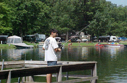
The Yankee Springs-Hall Lake Trail is a scenic hiking trail located in Barry County, Michigan. This moderate 3.5-mile loop trail winds through a beautiful forested area and offers stunning views of the picturesque Hall Lake.
The trail is well-maintained and accessible to hikers of moderate skill levels, making it a favorite among locals and visitors alike. The trail features a few inclines and declines, adding to the challenge and variety of the hike. The beautiful scenery and peaceful surroundings offer a welcome escape for anyone looking to relax and enjoy nature.
One of the highlights of the Yankee Springs-Hall Lake Trail is the opportunity to observe a variety of wildlife in their natural habitat. Visitors can spot a range of bird species, including woodpeckers and warblers, as well as small mammals like squirrels and chipmunks.
In addition to the stunning natural beauty, the Yankee Springs-Hall Lake Trail also features several scenic overlooks and benches along the way, offering visitors a chance to take a break and soak in the peaceful surroundings.
Overall, the Yankee Springs-Hall Lake Trail is a must-visit for anyone looking to experience the natural beauty of Barry County, Michigan. With moderate terrain, stunning lake views, and ample opportunities to observe wildlife, it’s no wonder that the Yankee Springs-Hall Lake Trail is a favorite among hikers of all skill levels. So, pack a picnic, lace up your hiking boots, and head to Barry County to discover the Yankee Springs-Hall Lake Trail.
If you are at the trail and this trail needs the latitude and longitude please click the link below and add it to the Add/Edit Trail Form to give us the information.
Click to view your current location on a map.
Starts across from the entrance of the Long Lake Outdoor Center, winds through the pines, follows the shoreline of Hall Lake and continues to Graves Hill. The return trail ‘back tracks’ to the intersection just below the crest of Graves Hill and then winds down the hill back to the starting point.
If you have information about this trail please fill out the Add/Edit Trail form.
References and More Info
- Compass Latitude: 42°36’51.8″N
- Compass Longitude: 85°29’19.5″W
- Numeric Latitude: 42.614381
- Numeric Longitude: ‘-85.488739
- Elevation in Feet:
- Elevation in Meters:
- Trail Measurement: 3.5 Miles
Leave a Reply