Address: West Lake Nature Preserve 420 S Shore Dr. Portage, MI 49002
Countie(s) trail is located in: Kalamazoo
Trail Type(s): Cross Country Skiing <> Hiking
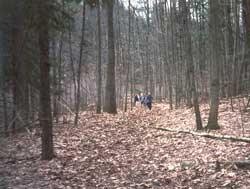
Trail Measurement: Trail: 2 Miles Area: 130 Acres
If you are at the trail and this trail needs the latitude and longitude please click the link below and add it to the Add/Edit Trail Form to give us the information.
Click to view your current location on a map.
Trail Map

If you have information about this trail please fill out the Add/Edit Trail form.
A large and unique sphagnum bog is the highlight of this site. Trails and decking sections carry visitors from dry upland forest areas through lowland forest, marsh, swamp, and finally onto the mat of sphagnum moss that grows in the bog. The dying moss forms a floating peat mass that may be up to 40 feet in depth. A network of special plastic decking actually “floats” right on top of this dense mat of moss. During times of high water, your feet may get slightly wet on this deck.
Wildlife Viewing
Bogs are home to some strange plants and animals that are highly specialized for life in a wet, acidic environment. One of these is the carnivorous (meat-eating) pitcher plant, which is fairly common here. The pitcher plant has specialized leaves that look like small pitchers or vases. These leaves collect and hold rainwater. When the plant’s fragrant nectar attracts insects, they become trapped in tiny hairs and drown in the pitchers, where they are digested with special enzymes.
Other unique plants found in the nature preserve include bladderwort, pink lady’s slipper, leatherleaf, cotton grass sedge, tamarack, and bog cranberry.
Contact the Portage Department of Parks and Recreation for the Wander the Wetlands brochure that explains more about this rare and unusual bog community.
Directions
From I-94 in Kalamazoo, take Exit 76. Travel south on South Westnedge for 3 miles to South Shore Drive. Turn left (east) onto South Shore and look for site entrance on the left side of the road.
Ownership: City of Portage
Size: 130 acres
Closest Town: Portage
Facilities and Opportunities:
- Restrooms
- Trails – Over 2 miles of easy walking trails with a self-guided tour.
- Picnic
- Drinking-Water
- Barrier-Free
References and More Info
- DNR
- Compass Latitude: 42°11’14.2″N
- Compass Longitude: 85°35’08.3″W
- Numeric Latitude: 42.1872772
- Numeric Longitude: ‘-85.5856492
- Elevation in Feet:
- Elevation in Meters:
- Trail Measurement: Trail: 2 Miles Area: 130 Acres
Leave a Reply