Tag: Hiking
-

Homestead Ski Trail
Address: 46.0297222,-88.7083333 Countie(s) trail is located in: Iron Trail Type(s): Downhill Skiing Trail Measurement: If you are at the trail and this trail needs the latitude and longitude please click the link below and add it to the Add/Edit Trail Form to give us the information. Click to view your current location on a map.…
-
Honeymoon Lake Snowmobile Trail
Address: 43.8027896,-85.9772872 Countie(s) trail is located in: Newaygo Trail Type(s): Hiking <> Snowmobile Trail Measurement: If you are at the trail and this trail needs the latitude and longitude please click the link below and add it to the Add/Edit Trail Form to give us the information. Click to view your current location on a…
-
Hoot Owl Ski Trail
Address: 44.5186111,-85.9875 Countie(s) trail is located in: Benzie Trail Type(s): Downhill Skiing Trail Measurement: If you are at the trail and this trail needs the latitude and longitude please click the link below and add it to the Add/Edit Trail Form to give us the information. Click to view your current location on a map.…
-
Hemlock Ski Trail
Address: 45.1611111,-84.9347222 Countie(s) trail is located in: Charlevoix Trail Type(s): Downhill Skiing Trail Measurement: If you are at the trail and this trail needs the latitude and longitude please click the link below and add it to the Add/Edit Trail Form to give us the information. Click to view your current location on a map.…
-
Horseshoe Bay Trail
Address: 45.9458465,-84.7458851 Countie(s) trail is located in: Mackinac Trail Type(s): Hiking Trail Measurement: 6.4 Miles If you are at the trail and this trail needs the latitude and longitude please click the link below and add it to the Add/Edit Trail Form to give us the information. Click to view your current location on a…
-

Hart Montague Linear State Park
Trail Map Address: 43.655676,-86.411137Countie(s) trail is located in: OceanaTrail Type(s): Cross Country Skiing <> Hiking <> Mountain Biking <> SnowmobileTrail Measurement: 4 MilesIf you are at the trail and this trail needs the latitude and longitude please click the link below and add it to the Add/Edit Trail Form to give us the information. Click…
-
Hartwick Pines State Park
Address: 44.740687,-84.664512 Countie(s) trail is located in: Crawford Trail Type(s): Camping <> Cross Country Skiing <> Fishing <> Hiking <> Mountain Biking <> Canoe/Kayak Trail Measurement: Trail: 20 Miles & Area: 9,672 Acres If you are at the trail and this trail needs the latitude and longitude please click the link below and add it…
-
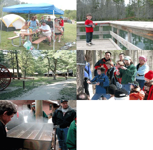
Hartwick Pines-Aspen Trail
Address: Hartwick Pines State Park 4216 Ranger Rd Grayling, MI 48738 Countie(s) trail is located in: Crawford Trail Type(s): Camping <> Cross Country Skiing <> Fishing <> Hiking <> Mountain Biking Trail Measurement: 3 Miles If you are at the trail and this trail needs the latitude and longitude please click the link below and…
-
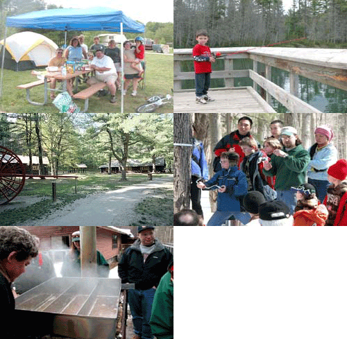
Hartwick Pines-Au Sable River Trail
Address: Hartwick Pines State Park 4216 Ranger Rd Grayling, MI 48738 Countie(s) trail is located in: Crawford Trail Type(s): Camping <> Cross Country Skiing <> Fishing <> Hiking Trail Measurement: 3 Miles If you are at the trail and this trail needs the latitude and longitude please click the link below and add it to…
-
Hartwick Pines-Bright and Glory Lakes Trail
Address: Hartwick Pines State Park 4216 Ranger Rd Grayling, MI 48738 Countie(s) trail is located in: Crawford Trail Type(s): Camping <> Cross Country Skiing <> Fishing <> Handicap Accessible <> Hiking Trail Measurement: 0.25 Miles If you are at the trail and this trail needs the latitude and longitude please click the link below and…