
Tag: Hiking
-

Lossie Road Nature Trail
Address: 44.79283,-85.38390 Countie(s) trail is located in: Grand Traverse Trail Type(s): Cross Country Skiing <> Hiking <> Snowshoe Trail Measurement: 1.8 Miles If you are at the trail and this trail needs the latitude and longitude please click the link below and add it to the Add/Edit Trail Form to give us the information. Click…
-
Lost Lake Pathway
Address: 44.67184,-85.798668 Countie(s) trail is located in: Grand Traverse Trail Type(s): Camping <> Cross Country Skiing <> Fishing <> Hiking <> Mountain Biking <> Snowshoe <> Canoe/Kayak Trail Measurement: 6.3 Miles If you are at the trail and this trail needs the latitude and longitude please click the link below and add it to the…
-

Lost Nation Trail
Address: 44.834246, -85.562805 Countie(s) trail is located in: Hillsdale Trail Type(s): Cross Country Skiing <> Hiking Trail Measurement: Trail: 1.5 Miles & Area: 2,500 acres If you are at the trail and this trail needs the latitude and longitude please click the link below and add it to the Add/Edit Trail Form to give us…
-
Lost Tamarack Pathway
Address: 45.300819, -84.722913 Countie(s) trail is located in: Cheboygan Trail Type(s): Camping <> Cross Country Skiing <> Hiking <> Mountain Biking Trail Measurement: 4.75 Miles If you are at the trail and this trail needs the latitude and longitude please click the link below and add it to the Add/Edit Trail Form to give us…
-
Love Creek County Park & Nature Center
Address: Love Creek Nature Center 9292 Huckleberry Rd Berrien Center, MI 49102 Countie(s) trail is located in: Berrien Trail Type(s): Cross Country Skiing <> Hiking <> Mountain Biking <> Road Biking <> Snowshoe Trail Measurement: 6 Miles If you are at the trail and this trail needs the latitude and longitude please click the link…
-
Lower Gorge Ski Trail
Address: 44.5197222,-85.9936111 Countie(s) trail is located in: Benzie Trail Type(s): Downhill Skiing Trail Measurement: If you are at the trail and this trail needs the latitude and longitude please click the link below and add it to the Add/Edit Trail Form to give us the information. Click to view your current location on a map.…
-
Lincoln Brick Park
Address: Lincoln Brick Park 13991 Tallman Rd Grand Ledge, MI 48837 Countie(s) trail is located in: Eaton Trail Type(s): Cross Country Skiing <> Fishing <> Hiking <> Swimming Trail Measurement: Trail: 3 Miles & Area: 90 Acres If you are at the trail and this trail needs the latitude and longitude please click the link…
-
Mac Gully Ski Trail
Address: 45.4705556,-84.9416667 Countie(s) trail is located in: Emmet Trail Type(s): Downhill Skiing Trail Measurement: If you are at the trail and this trail needs the latitude and longitude please click the link below and add it to the Add/Edit Trail Form to give us the information. Click to view your current location on a map.…
-
Lincoln Mills Snowmobile Trail
Address: 44.1330636,-85.7522844 Countie(s) trail is located in: Lake Trail Type(s): Hiking Snowmobile Trail Measurement: If you are at the trail and this trail needs the latitude and longitude please click the link below and add it to the Add/Edit Trail Form to give us the information. Click to view your current location on a map.…
-
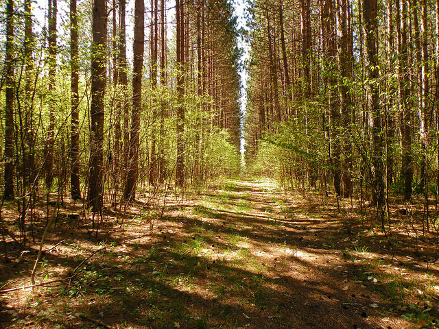
MacKenzie Trail
Address: 44.249943,-85.73402Countie(s) trail is located in: WexfordTrail Type(s): Cross Country Skiing <> Hiking <> Mountain Biking <> SnowshoeTrail Measurement: 10.1 MilesIf you are at the trail and this trail needs the latitude and longitude please click the link below and add it to the Add/Edit Trail Form to give us the information. Click to view…