

Address: 44.895960, -86.018567
Countie(s) trail is located in: Leelanau
Trail Type(s): Cross Country Skiing <> Handicap Accessible <> Hiking <> Inline Skating <> Mountain Biking <> Road Biking
Trail Measurement: 9.7 Miles
If you are at the trail and this trail needs the latitude and longitude please click the link below and add it to the Add/Edit Trail Form to give us the information.
Click to view your current location on a map.
End Points:
- 44.895960, -86.018567
- 44.893024, -85.994791
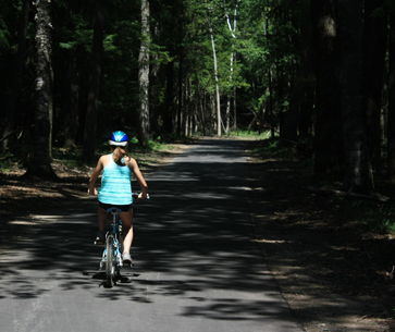
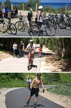
A great way to get to many of the places within the Lakeshore, the Sleeping Bear Heritage Trail is a paved, non-motorized, multi-use trail planned to span 27 miles from the northern end of Sleeping Bear Dunes National Lakeshore at County Road 651 to the Leelanau/Benzie County line at Manning Road south of Empire. Currently, the trail runs over 9 miles from the village of Empire to the Pierce Stocking Scenic Drive, the Dune Climb, Glen Haven Historic Village, D.H. Day Campground, and on into the village of Glen Arbor. The next segment of trail to be built will go north from Glen Arbor to Port Oneida Road in 2015. The main trailhead is at the Dune Climb. The trail begins at the north end of the parking lot there. Other trailheads can be found at the base of Alligator Hill on Day Forest Road in Glen Arbor; at Glen Haven, at Pierce Stocking Scenic Drive, and at the intersection of Voice and Bar Lake Roads near Empire (soon!). A park pass is required to use the trail within the park.
This trail is handicap accessible and is designed for walkers, runners, skiers, people on bicycles, wheelchairs, and babies in strollers. Some stretches have steep grades, and these are noted on trailhead signs and are marked with warning signs on the trail. Because people will be using the trail in a variety of ways, please be aware of others going at different speeds.
The historic logging village of Glen Haven is only 2 miles away from the Dune Climb, so park your car there and ride your bike or walk along the base of the dunes and through the cedar forest to the museums, blacksmith shop, general store, and beaches of Glen Haven.
The Friends of Sleeping Bear Dunes manages and maintains the bike trail. They have over 40 Trail Ambassadors who ride or walk the trail on a regular basis. If you see one of these folks wearing the bright orange vest, feel free to ask them questions about the trail or the Park. They’ll be happy to assist you.
Distance: 9.7 miles one way
Terrain: Flat between the Dune Climb and Glen Arbor; hilly between the Dune Climb and Empire.
Vegetation: Field and beech-maple forest, white cedar stands
If you have information about this trail please fill out the Add/Edit Trail form.
References and More Info
- Compass Latitude: 44°53’45.5″N
- Compass Longitude: 86°01’06.8″W
- Numeric Latitude: 44.895960
- Numeric Longitude: ‘-86.018567
- Elevation in Feet:
- Elevation in Meters:
- Trail Measurement: 9.7 Miles
Leave a Reply