
Address: 44.249943,-85.73402
Countie(s) trail is located in: Wexford
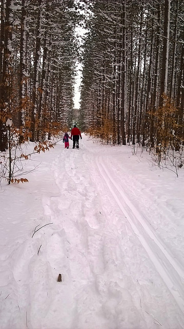
Trail Type(s): Cross Country Skiing <> Hiking <> Mountain Biking <> Snowshoe
Trail Measurement: 10.1 Miles
If you are at the trail and this trail needs the latitude and longitude please click the link below and add it to the Add/Edit Trail Form to give us the information.
Click to view your current location on a map.
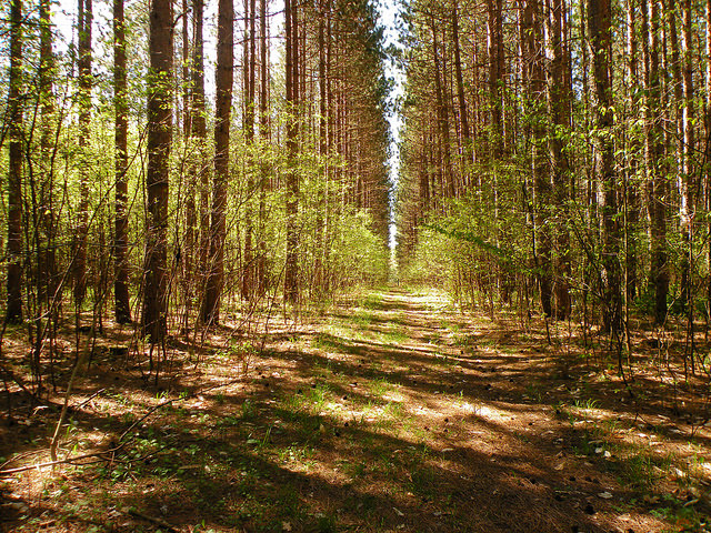
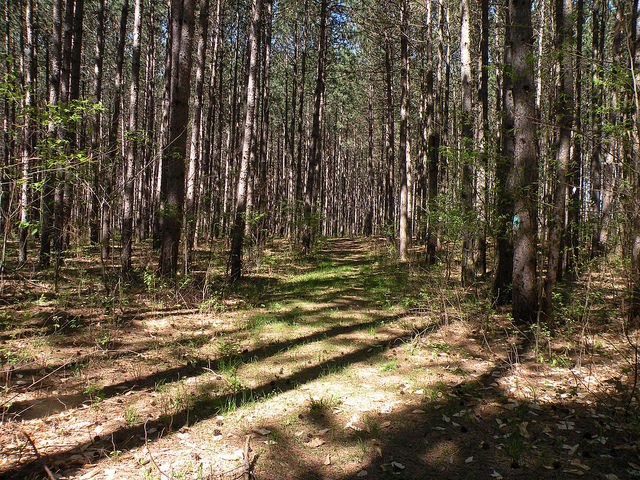
The trail is 10.1 miles with loop combinations of varying lengths available. The trail is marked with blue diamond-shaped blazes. There are signs at each junction with a You Are Here map. The McKenzie trail system is located just northwest of the Caberfae ski area. Loops range from beginner to most difficult. Some trails are groomed in the winter.
At a Glance
Current Conditions: This trail is groomed.
Operational Hours: Open 24 hours a day, 7 days a week, unless otherwise posted.
Area Amenities: Parking
Fees: No Fee
Permit Info: Special Use Permit –
No special use permit is required for individuals or small groups (74 people or less).
Permits are required for a commercial event, or large groups (75 people or more).
Open Season: January 1 – December 31
Best Season: January 1 to December 31
Restrictions:
Allowed –
Nonmotorized nonsnow use
Nonmotorized snow use
Prohibited –
Motorized vehicles
Motorized over-snow vehicles
Forest-Wide Closures: – Camping in dispersed areas:
Camping within two hundred (200) feet of any body of water, except at designated sites.
Camping in an area which is posted closed and/or no camping.
Camping within 450 feet of developed recreation areas.
Being publicly nude.
Storing Watercraft: Storing, mooring, or leaving a boat or raft over 24 hours.
Parking: Parking in violation of posted instructions.
Closest Towns: Mesick, Cadillac
Operated By: Cadillac Manistee Ranger District – 412 Red Apple Rd., Manistee, MI 49660
General Information
Directions:
From Cadillac –
- Travel west on M-55 for 12 miles.
- Turn right and travel north on 13 Mile Rd. for 2 miles.
- Veer right at the fork and travel northeast on 13 Mile Rd. for .1 miles.
- Turn left and travel west on 38 Rd. for 1.5 miles.
- Turn left and travel south on FR 9833 to the entrance.
General Notes:
Location –Caberfae Area, Lake Mitchell
Nearby Recreation Areas –
- Hemlock Campground
- Briar Hills Semi-Primitive Nonmotorized Area
- Caberfae Scenic Overlook
- MacKenzie Cross-Country Ski and Mountain Bike Trail
- Big “M” Cross-Country Ski and Mountain Bike Trail
County – Wexford
Seasonal and Other Information –
- This site is not gated during the off-season.
- This site is not maintained in winter:
- Access road and/or parking lot are plowed.
Amenities
Parking: 14 vehicle capacity
If you have information about this trail please fill out the Add/Edit Trail form.
References and More Info
- Compass Latitude: 44°14’59.8″N
- Compass Longitude: 85°44’02.5″W
- Numeric Latitude: 44.249943
- Numeric Longitude: ‘-85.73402
- Elevation in Feet:
- Elevation in Meters:
- Trail Measurement: 10.1 Miles
Leave a Reply