
Address: Kal-Haven Trail State Park 4143 10th St N Kalamazoo, MI 49009
Countie(s) trail is located in: Kalamazoo
Trail Type(s): Cross Country Skiing <> Hiking <> Horseback/Equestrian <> Rock Climbing <> Snowmobile
Trail Measurement: Trail: 34.1 Miles & Area: 85 Acres
If you are at the trail and this trail needs the latitude and longitude please click the link below and add it to the Add/Edit Trail Form to give us the information.
Click to view your current location on a map.
Recreation Passport Required: No
Approximate Size: 85 (Acres)
The Kal-Haven Trail is a preferred destination for those who enjoy hiking, biking, cross-county skiing, and snowmobiling. There is an 11-mile parallel section where horses are allowed. The staging area for horses is at 67th street and Baseline.
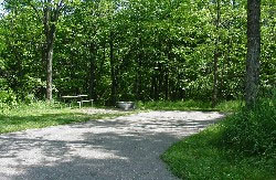
The 33-mile former railroad bed has a limestone/slag surface. Linking the city of South Haven to the city of Kalamazoo the trail crosses over bridges, passes through small towns, and by points of historical interest.
To reach the Kalamazoo trailhead, take US-31 west of Kalamazoo to M-43. Go west on M-43 a quarter-mile and drive north on 10th Street two miles. To reach the South Haven trailhead, take I-196 to exit 22 (North Shore Drive) and go west to the Blinking light (Blue Star or A2) go south on Blue Star (A2) for about 1 mile, turn right (west) on Wells Street for a quarter-mile, then right (north) on Baily Street to the park entrance.
The ski trail is not groomed.
Kal-Haven Trail State Park is a 34-mile crushed limestone path connecting South Haven and Kalamazoo. The trail meanders through wooded areas, past farmlands, and over rivers and streams. Trail highlights include a camelback bridge and a covered bridge.
To reach the Kalamazoo trailhead, take US-31 west of Kalamazoo to M-43. Go west on M-43 a quarter-mile and drive north on 10th Street two miles. To reach the South Haven trailhead, take I-196 to exit 22 (North Shore Drive) and go west to the Blinking light (Blue Star or A2) go south on Blue Star (A2) for about 1 mile, turn right (west) on Wells Street for a quarter-mile, then right (north) on Baily Street to the park entrance.
Annual passes are available through the Van Buren County Road Commission, by mail or in person, at its Lawrence office, 319 W. James St. The cost is $15 for one person and $35 for a family.
Features:
- Designated Watchable Wildlife Site
- Biking
- Hiking – Feature is ADA Compliant.
- Bridle Trails – Trails may have other designated uses.
- Snowmobile Area – Allowed with 4″ of snow or more on the ground.
- Cross Country Ski
If you have information about this trail please fill out the Add/Edit Trail form.
References and More Info
- Compass Latitude: 42°19’32.0″N
- Compass Longitude: 85°40’08.2″W
- Numeric Latitude: 42.325548
- Numeric Longitude: ‘-85.668955
- Elevation in Feet:
- Elevation in Meters:
- Trail Measurement: Trail: 34.1 Miles & Area: 85 Acres
Leave a Reply