Address: Bass River Recreation Area Grand Haven, MI 49417
Countie(s) trail is located in: Ottawa
Trail Type(s): Cross Country Skiing <> Hiking <> Horseback/Equestrian <> Mountain Biking <> Canoe/Kayak <> Swimming <> Fishing
Trail Measurement: Trail: 6 Miles & Area: 1,665 Acres
If you are at the trail and this trail needs the latitude and longitude please click the link below and add it to the Add/Edit Trail Form to give us the information.
Click to view your current location on a map.
Description
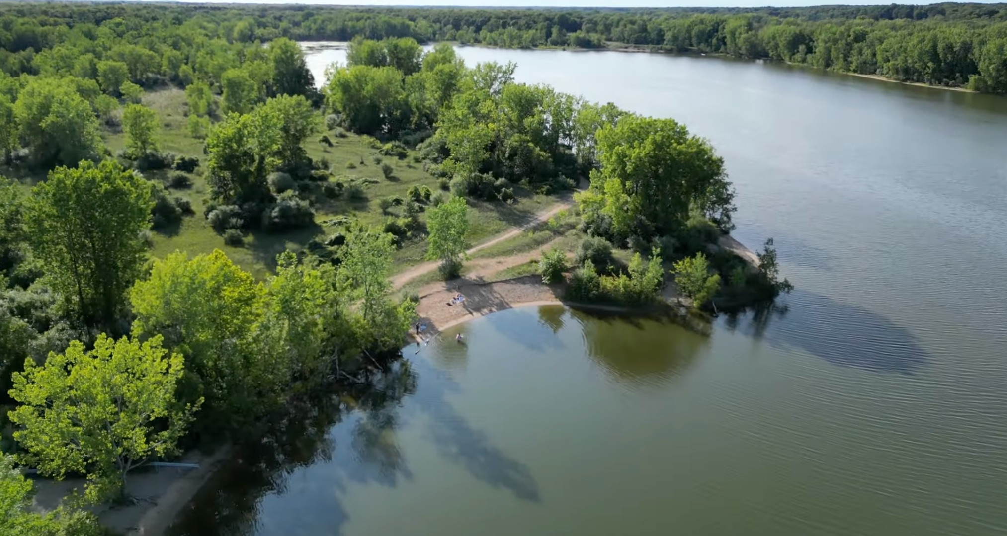
Bass River Recreation Area, a 1,665-acre site, consists of open meadows, open brushland, mature hardwoods, small ponds, and a 300-acre Max Lake. It has approximately three miles of frontage on the Grand River. The park is used primarily for boating, hiking, mountain biking, and horseback riding.
Bass River Recreation Area is a 1,665-acre (674 ha) recreation area, located in Allendale Charter Township and Robinson Township, Ottawa County, Michigan. There is a multi-purpose, 6-mile (9.7 km) trail that is used for cross-country skiing, hiking, horseback riding, and mountain biking. A gravel boat launch provides access to Max Lake and the Grand River. Hunting is allowed in the recreation area.
Directions:
M-45 to 104th Ave., North 2.5 miles to the west park entrance. Alt. Rte.: I-96 to Eastmanville exit, South 4 miles to Warner Rd., West 5.5 miles to South Cedar Dr., North 1 mile to park entrance.
Discover the Hidden Gem of Ottawa County: Bass River Recreation Area
Experience the natural beauty and diverse outdoor activities at Michigan’s Bass River Recreation Area. Your next adventure awaits!
Nestled in the heart of Ottawa County, Michigan, lies a treasure trove of outdoor wonders waiting to be explored – the Bass River Recreation Area. This hidden gem offers a perfect blend of natural beauty and recreational opportunities that will captivate nature enthusiasts and adventure seekers alike.
As you step into this serene oasis, you’ll be greeted by a network of winding hiking trails that meander through lush forests and open meadows. The trails cater to all skill levels, making it an ideal destination for both seasoned hikers and families looking for a leisurely stroll. Keep your eyes peeled for the diverse wildlife that calls this area home – from colorful songbirds to elusive white-tailed deer.
Water lovers rejoice! The Bass River Recreation Area boasts excellent opportunities for aquatic adventures. Cast your line into the tranquil waters and try your luck at catching some of Michigan’s prized fish species. Remember to obtain your fishing license before embarking on your angling expedition!
One of the most enchanting aspects of this recreation area is its ability to transform with the seasons, offering unique experiences throughout the year:
- Spring: Witness the awakening of nature as migratory birds return, filling the air with their melodious songs. It’s a birdwatcher’s paradise!
- Summer: Bask in the warm sunshine as you explore the trails or enjoy a peaceful picnic by the water’s edge.
- Fall: Marvel at the breathtaking display of autumn colors as the foliage transforms into a vibrant tapestry of reds, oranges, and golds.
- Winter: Embrace the snowy wonderland and glide through the pristine landscape on cross-country skis.
Whether you’re seeking a family-friendly outing or a peaceful retreat from the hustle and bustle of daily life, Bass River Recreation Area has something for everyone. The well-maintained trails and facilities ensure a comfortable and enjoyable experience for all visitors.
Before you embark on your adventure, take note of the trail usage guidelines to help preserve this natural wonder for future generations. By respecting the environment and following the rules, we can all play a part in maintaining the beauty and integrity of this special place.
Have you had the chance to explore Bass River Recreation Area? We’d love to hear about your experiences! Share your favorite memories, trail recommendations, or wildlife sightings in the comments below. Your insights could help fellow outdoor enthusiasts plan their perfect visit.
If you have any additional information about the trails or facilities at Bass River Recreation Area, why not contribute to the community’s knowledge? Visit Michigan Trails’ submission page to share your valuable insights and help others make the most of their visit to this incredible destination.
So, pack your hiking boots, grab your fishing rod, and get ready to create unforgettable memories at Bass River Recreation Area. Adventure awaits – will you answer the call of the wild?
References and More Info
Leave a Reply