Address:
Countie(s) trail is located in: Alger
Trail Type(s): Fishing <> Canoe/Kayak
Trail Measurement:
If you are at the trail and this trail needs the latitude and longitude please click the link below and add it to the Add/Edit Trail Form to give us the information.
Click to view your current location on a map.
Discover the Sturgeon River Trail in Michigan: A Nature Enthusiast’s Paradise
Michigan’s Sturgeon River Trail offers a unique blend of adventure and tranquility, making it a must-visit destination for outdoor enthusiasts. Located in the heart of Michigan’s lush landscapes, this trail provides a scenic route for various recreational activities.
Nearby Activities:
- Wildlife Watching: The area is rich in biodiversity, making it ideal for bird watchers and nature photographers.
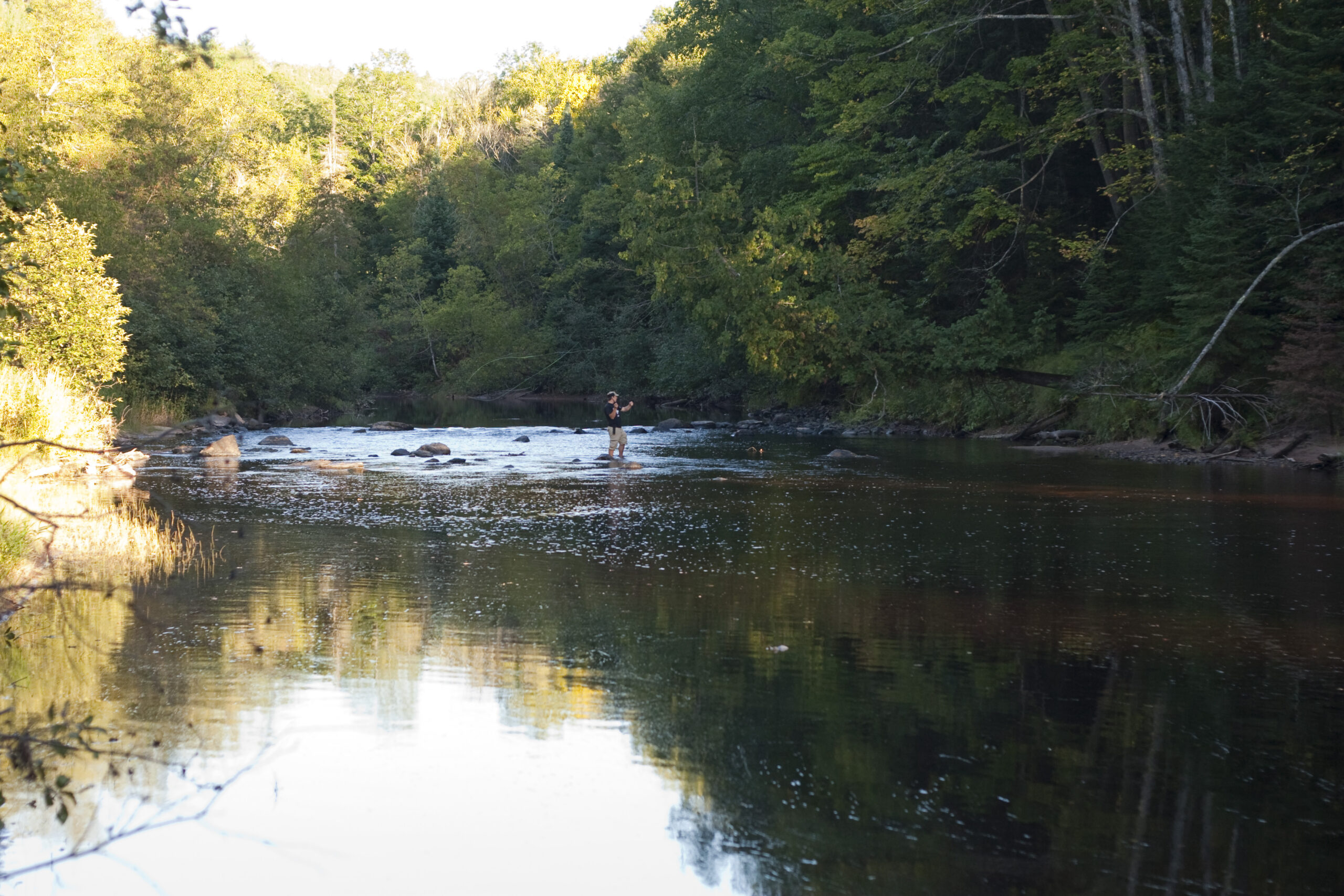
- Fishing: The Sturgeon River is known for excellent fishing opportunities, particularly for trout.
- Scenic Attractions: Visit the Sturgeon River Falls for a stunning view of the river’s natural waterfall.
Reviews and Online Buzz:
- The Sturgeon River Trail is praised for its well-maintained paths and the variety of activities it offers. Visitors appreciate the tranquility and the beauty of the natural surroundings, making it a perfect escape from the hustle and bustle of city life.
The Sturgeon River canoe trail starts 3 miles west of Forest Highway 13 at County Road 440 near the Alger-Delta County line. This is approximately 35 miles east of Rapid River, and 44 miles west of Manistique. The trail is 41 miles in length and has six access points. Most lands along the Sturgeon River are National Forest Lands, but private properties exist. If you intend to camp, check your map to be sure you do not trespass on private properties. There are primitive camping areas and one developed campground. Waterfowl and deer sightings are common. Brown trout fishing is best north of US 2. Steelhead, brook trout, and salmon also frequent the river. The Sturgeon River is a relatively slow-moving river with many meanders. Fallen trees and heavy brush occasionally block the river and require portaging. Two areas of rapids and rock riffles add excitement to the trip.
Early summer and late fall are the best times to canoe the Sturgeon River. Two rapids challenge canoers; elusive brown trout, steelhead, and salmon challenge anglers. This river flows through a narrow, dissected, gorge-like valley with an average depth of 200-300 feet, and through the Sturgeon River Gorge Wilderness.
Designated Reach: March 3, 1992. From the north line of Section 26, T43N, R19W, to Lake Michigan.Classification/Mileage: Scenic — 21.7 miles; Recreational — 22.2 miles; Total — 43.9 miles.
Hiawatha National Forest
2727 North Lincoln Road
Escanaba, Michigan 49829
The Sturgeon River canoe trail starts 3 miles west of Forest Highway 13 at County Road 440 near the Alger-Delta County line in the Hiawatha National Forest. This is approximately 35 miles east of Rapid River, and 44 miles west of Manistique. The trail is 41 miles in length and has six access points. Most lands along the Sturgeon River are National Forest Lands, but private properties exist.
If you intend to camp, check your map to be sure you do not trespass on private properties. There are primitive camping areas and one developed campground. Waterfowl and deer sightings are common. Brown trout fishing is best north of US 2. Steelhead, brook trout, and salmon also frequent the river.
The best time to canoe the Sturgeon River is when the water is high, between April 30 and the end of June, or after mid-September. The Sturgeon River is a relatively slow-moving river with many meanders. Fallen trees and heavy brush occasionally block the river and require portaging. Two areas of rapids and rock riffles add excitement to the trip. Flows through central upper peninsula farm and forest land. Good floating and fishing opportunity. A generally narrow stream.
References and More Info
- Compass Latitude:
- Compass Longitude:
- Numeric Latitude:
- Numeric Longitude:
- Elevation in Feet:
- Elevation in Meters:
- Trail Measurement:
Leave a Reply