
Address: Platte River State Forest Campground Homestead, MI
Countie(s) trail is located in: Benzie
Trail Type(s): Camping <> Fishing <> Hiking <> Mountain Biking <> Canoe/Kayak
Trail Measurement: 2.5 Miles
If you are at the trail and this trail needs the latitude and longitude please click the link below and add it to the Add/Edit Trail Form to give us the information.
Click to view your current location on a map.
Recreation Passport Required: Yes
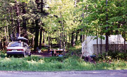
The phone number indicated above is for the Management Unit. Sites available on a first-come, first-serve basis. No reservations. 26 sites for tent and small trailer use. Located on the Platte River near the Platte River Hatchery. Excellent canoeing and trout fishing. Rustic campground includes vault toilets and potable water from well hand pump.
Trails
| Platte Springs Pathway |
| Trail Length in Miles: 2.50 (Miles) |
| Biking, Hiking |
Trail Distance:
Hiking: Platte Springs (on-site): 2.5 miles of hilly terrain with interpretive trail marking points of interest.
Mountain Biking: Platte Springs (on-site): 2.5 miles of hilly terrain with interpretive trail marking points of interest.
The campground is accessible by water. Canoeing opportunities on the Platte River.
Features:
- Designated Watchable Wildlife Site
- Fishing
- Canoeing
- Hiking
- Mountain Biking
If you have information about this trail please fill out the Add/Edit Trail form.
References and More Info
- Compass Latitude: 44°38’35.9″N
- Compass Longitude: 85°59’05.4″W
- Numeric Latitude: 44.643312
- Numeric Longitude: ‘-85.98483
- Elevation in Feet:
- Elevation in Meters:
- Trail Measurement: 2.5 Miles
Leave a Reply